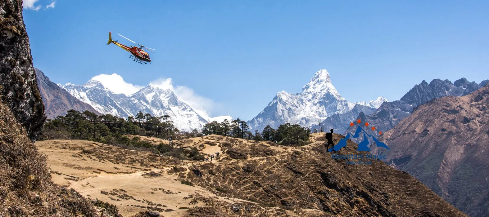
The Everest region changes slowly as you move higher. Green hills become rocky paths, forests become smaller, and large glaciers begin to appear around the trail.
The Everest Base Camp Trek With Helicopter Return gives travelers the chance to experience these changes on foot without spending several extra days walking back after reaching the high points.
The listed itinerary lasts 10 days and includes acclimatization in Namche Bazaar and Dingboche. It reaches Everest Base Camp and Kala Patthar before the helicopter flight back toward Kathmandu.
Begin With the Sherpa Trail
The journey starts with a helicopter flight from Kathmandu to Lukla. From Lukla, the walking section begins toward Phakding.
The lower trail has green hills, rivers, forests, monasteries, and Sherpa settlements.
Let the First Day Set Your Pace
The first walking day is relatively short.
Use it to get comfortable with your shoes, backpack, and walking rhythm.
There is no reason to rush.
A calm start can help you save energy for the much harder sections ahead.
Follow the Dudh Koshi
The Dudh Koshi River stays close to parts of the lower trail.
You will cross suspension bridges and pass through villages as you move toward Namche Bazaar.
Enjoy the Bridges and Villages
The bridges are not only useful crossings.
They also offer interesting views of the river and valley below.
Along the route, you may see prayer flags, stone walls, local homes, and people moving supplies between villages.
These everyday details show another side of the Everest region.
Namche Is Your First Big Pause
The route from Phakding to Namche takes around six to seven hours according to the listed itinerary.
The final climb toward Namche is one of the tougher parts of the lower trail.
Use Acclimatization Properly
The itinerary includes a full acclimatization day in Namche.
You can take a short hike toward the Everest View Hotel or explore nearby Sherpa villages.
The point is not to complete another major trek.
Your body needs time to adjust before you continue higher.
Tengboche Brings a Cultural Break
From Namche, the trail continues toward Tengboche.
The village is home to one of the best-known Buddhist monasteries in the Everest region and offers wide mountain views.
Slow Down Around the Monastery
If you visit the monastery, respect the local customs.
Observe quietly.
Follow instructions about photography.
Take time to appreciate the setting rather than treating the stop as another item to check off your list.
The cultural side of the Khumbu is just as important as its mountains.
Dingboche Feels More Remote
The trail from Tengboche to Dingboche gradually leaves more forest behind.
At around 4,410 meters, the air is thinner and the landscape is more open.
Your Walking Style Needs to Change
This is where patience becomes important.
You may need to walk slower than you did earlier.
That is completely normal.
Take short breaks and drink water regularly.
The itinerary includes another acclimatization day here, with an optional hike toward Nangkartshang Peak.
The Landscape Turns Rocky
Beyond Dingboche, the trail becomes increasingly rugged.
Large peaks, rocky slopes, glaciers, and open valleys replace much of the greenery seen earlier.
Look Back Sometimes
It is easy to keep staring at the trail ahead.
Turn around occasionally.
The view behind you can show how much the landscape has changed since leaving the lower valleys.
You can also see how small the villages become as you gain altitude.
Lobuche Brings the High Mountains Closer
The trail from Dingboche to Lobuche takes around four to five hours.
The route passes through Thukla and continues beside the Khumbu Glacier.
Pause at Thukla
The memorials around Thukla honor climbers who died in the Everest region.
It is a quiet place to stop and think.
Everest is often shown through beautiful photographs, but the mountains also demand serious preparation and respect.
Cold, altitude, weather, and difficult terrain can all create problems.
Gorakshep Is the Last Major Stop
Gorakshep sits at about 5,125 meters.
At this height, even a normal walking day can feel difficult.
Leave Your Heavy Things Behind
For the Base Camp walk, you can use a small daypack.
Carry water, snacks, warm layers, sun protection, and other essentials.
There is no reason to make a high-altitude walk harder by carrying unnecessary weight.
Walk to Everest Base Camp
The listed route from Lobuche to Gorakshep, Everest Base Camp, and back to Gorakshep takes around seven to nine hours. Everest Base Camp is listed at approximately 5,364 meters.
Give Yourself Time at Base Camp
When you reach Base Camp, stop and enjoy the moment.
Take photographs.
Look toward the glacier and surrounding mountains.
Think about the distance you have already walked.
You started among green hills and have gradually reached a cold, high-altitude landscape.
That change is the real story of the trek.
Kala Patthar Offers the Big View
Kala Patthar is listed at approximately 5,545 meters, making it the highest point on the itinerary.
It is known for its wide views of Everest and nearby peaks.
Sunrise Changes the Mountains
The climb begins early, when temperatures can be very cold.
But the first sunlight slowly reaches the peaks.
Everest, Pumori, Lhotse, Nuptse, and the surrounding glaciers become brighter as the morning develops.
Take your time at the viewpoint.
You have come a long way to see this.
The Return Takes a New Direction
After Kala Patthar, the Everest Base Camp Trek With Helicopter Return leaves the traditional walking route behind.
Instead of spending several more days retracing the trail, you return by helicopter.
See the Khumbu From Above
The aerial view changes everything.
The trails that seemed long now look tiny.
Villages appear small between huge valleys.
Rivers become thin lines.
Glaciers and mountain ridges seem to connect into one enormous landscape.
After walking through the region, seeing it from the air gives you a completely different understanding of its size.
Weather Can Affect the Flight
Mountain helicopter travel depends on conditions.
Clouds, wind, and visibility can change the timing.
The listed itinerary notes that the Gorakshep-to-Kathmandu flight can take about one and a half hours in clear conditions, although actual timing can vary.
Keep Your Plans Flexible
Do not create a tight schedule immediately after the helicopter return.
If you have another important flight, leave extra time.
A flexible plan is simply smarter when traveling through the Himalayas.
The Route Is More Than a Way to Reach Everest
The Everest Base Camp Trek With Helicopter Return is interesting because every section feels different.
The lower trail introduces you to Sherpa villages and green valleys.
Namche gives your body time to adjust.
Tengboche brings culture and mountain views.
Dingboche prepares you for the high altitude.
Lobuche introduces the glacier landscape.
Base Camp marks the main goal.
Kala Patthar gives you a wider view.
Then the helicopter allows you to see the entire route from above.
The Final View Completes the Experience
The helicopter return is not simply about saving time.
It gives you a final chance to look at places you already experienced from the ground.
You may recognize a village.
You may spot the river you crossed.
You may see the trail that took hours to walk.
That is what makes the Everest Base Camp Trek With Helicopter Return different.
You first experience the Himalayas slowly, one step at a time.
Then you leave with a much wider view of the same landscape.
FAQs
How long is the listed itinerary?
The trip is planned for 10 days from arrival to departure in Kathmandu.
Where are the acclimatization days?
Acclimatization days are included in Namche Bazaar and Dingboche.
How high is Everest Base Camp?
The listed elevation is approximately 5,364 meters.
What is the highest point?
Kala Patthar is listed at approximately 5,545 meters.
Is Base Camp reached on foot?
Yes. The itinerary includes walking to Everest Base Camp before the helicopter return.
Can weather affect the helicopter?
Yes. Weather and visibility can affect helicopter operations and flight timing.
